Blue Ridge Parkway
October 8, 2021
Blue Ridge Parkway
It was just about a year ago when I found myself driving the Blue Ridge Parkway after having cut across the Smoky Mountains and through Smoky Mountain National Park on my way to Winston-Salem to visit my mother Marta in Winston-Salem. I was headed north on that trip and alone, but this time I was headed south, with my wife Kathy as we made our meandering way towards our home in Key West.
We had driven across North Carolina from the Virginia coast as I wanted to drive through the mountains and experience the beginnings of the beautiful annual fall foliage as the leaves were just beginning to change as we took the slow drive across Carolina to meet up with the parkway near Boone.
The Blue Ridge parkway is the longest linear park in the United States, the road stretches for 469 miles from Virginia through North Carolina along the Blue Ridge, which is a spine that traverses the top of a section of the Appalachian Mountains. The speed limit never tops 45 mph and the road twists and turns and goes through the mountains. Sometimes literally as there are a number of tunnels that carve their way through some sections.
The route offered us numerous opportunities to stop and either take in the beautiful vistas, take hikes from trailheads that start from the parkway or even visit a couple of the cities that the parkway passes through. We stopped for dinner and to spend the night in Asheville, North Carolina before continuing south the following morning to the southern terminus of the road which is in Smoky Mountains National Park.
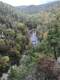
We did stop to take in some of the natural beauty along the parkway. The first stop was at Linville Falls, which is a series of stepped waterfalls located a short hike from the parkway. The falls move in several distinct steps, beginning in a twin set of upper falls, moving down a small gorge, and culminating in a high-volume 45-foot (14 m) drop. It is named for the Linville River, which goes over the falls
We walked the entire length of the trails that lead to various overlooks of the falls from different angles and perspectives on what was a beautiful fall day to be outside. The falls are pretty cool and impressive and the hike up to the overlooks is pretty cool.
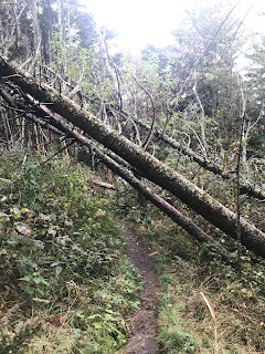
Our second stop was at what is the highest point of the parkway, just below Richard Balsam Mountain. The elevation at the parkway is 6,053 ft and there is a trailhead to the trail that leads to the summit of Richard Balsam Mountain which Kathy and I decided to hike. Richard Balsam Mountain is the ninth highest peak in the Eastern United States with a peak elevation of 6,410 ft.
Richland Balsam's upper elevations (above approximately 5,500 feet) support part of one of just ten stands of Southern Appalachian spruce-fir forest. This forest type consists of two dominant tree types— the red spruce and the Fraser — commonly called the "he-balsam" and "she-balsam" respectively, although the latter has been decimated in recent decades by the balsam wooly adelgid infestation. It is a beautiful and wonderfully place to hike.
Our final stop was at the Oconaluftee River basin in Smoky Mountain National Park, where last year I saw hundreds of wild elk and was hopeful to see more and let Kathy have the opportunity to experience seeing them. Unfortunately, the massive numbers of elk where not to be found this time. They were in the area as we could hear the bellowing of the adult males out in the distance across the river, but we only saw one actual wild boar, that was bedded down in the reeds along the riverbank. I guess our timing was a bit off, but I must say that even seeing a single large bull elk is a pretty cool experience


0 Comments:
Post a Comment
<< Home